A recent research introduces UrbanRadio3D, the largest high-resolution 3D radio map dataset, and RadioDiff-3D, a generative diffusion AI model that accurately predicts 3D wireless signal characteristics for advanced 6G environment-aware communication.
Imagine your phone could always get the strongest signal, drones could fly without losing connection, and smart cities could deliver ultra-fast internet everywhere — sounds futuristic, right? Well, with 6G just around the corner, researchers are making big strides to make it happen!
A new research paper titled "RadioDiff-3D: A 3D×3D Radio Map Dataset and Generative Diffusion Based Benchmark for 6G Environment-Aware Communication" introduces two game-changing innovations:
UrbanRadio3D: The largest, most detailed 3D radio map dataset ever built.
RadioDiff-3D: An AI-powered diffusion model that predicts how radio signals move through complex urban spaces.
Let’s break it down and explore how this could reshape the future of wireless networks!
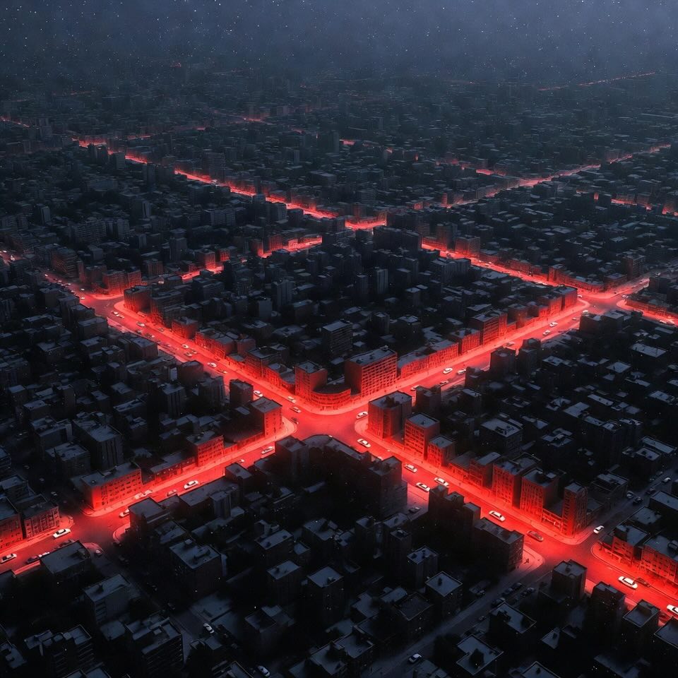
To understand this research, first we need to get what radio maps are. Radio maps show how wireless signals spread across an area — much like a heatmap for internet strength. They help networks:
However, most current methods:
With 6G networks promising blazing speeds, low latency, and new services (like flying taxis), there’s a need for 3D, detailed, real-time radio maps — and that’s where this research comes in!
The researchers created UrbanRadio3D, a massive dataset made using high-fidelity simulations of real-world cities like London, Berlin, and Glasgow.
3D Environment: Covers 20 height levels (1m to 20m), capturing vertical signal behavior.
Multi-Modal Data: Includes:
High Resolution: 1-meter granularity both horizontally and vertically — meaning super detailed maps!
Massive Scale: Over 11 million data points, 200 transmitter locations, across 701 city blocks
This dataset is 37× bigger and 7× more detailed vertically than any previous benchmark!
You can even explore this dataset yourself: Link in the research paper.
Collecting real-world radio maps is expensive and slow, especially in 3D. Enter RadioDiff-3D, a clever AI model based on diffusion models — the same technology behind advanced image generators like DALL-E!
RadioDiff-3D:
It produces high-quality 3D radio maps in a fraction of the time compared to traditional simulations.
The research team tested RadioDiff-3D extensively and found:
This is a huge step forward because it means future 6G systems could self-update their radio maps in real-time and adapt to dynamic environments like busy cities, stadiums, or even aerial spaces.
For Everyday Users: Better coverage, faster speeds, and fewer dropped calls
For Drones and Aerial Vehicles: Safer, more efficient flight paths without signal loss
For Smart Cities: Easier network planning, optimized antenna placement, and energy savings
For Emerging Applications: Supports low-latency services like AR/VR, remote surgery, and autonomous vehicles
In short: smarter networks, happier users, more reliable services!
This research opens several exciting future directions:
Multi-band Expansion: Adding different frequency bands (like sub-6GHz or THz) to the dataset.
Cross-City Generalization: Training AI to adapt to unseen cities or environments.
Even Faster Models: Using transformers or other modern AI architectures to speed up generation further.
Outdoor-Indoor Transitions: Expanding datasets to handle indoor/outdoor transitions seamlessly.
In the next few years, we could see real-time 3D radio map generation becoming a standard part of 6G deployments globally!
The combination of UrbanRadio3D and RadioDiff-3D is a milestone for 6G research. With detailed, multi-modal 3D radio maps and AI-powered fast generation, the future of wireless communication looks smarter, faster, and more adaptable than ever.
Radio Map (RM) - A map that shows how strong or weak wireless signals are across a physical area — like a heatmap for signal coverage.
Pathloss - How much the signal weakens (loses power) as it travels from the transmitter to the receiver — lower means stronger signal!
Direction of Arrival (DoA) - The direction (angle) from which a wireless signal arrives at a receiver — useful for figuring out where the signal comes from.
Time of Arrival (ToA) - How long it takes for a signal to travel from the transmitter to the receiver — handy for locating devices and measuring delays.
3D Radio Map - A radio map that doesn’t just show signal strength on the ground (2D), but also includes building heights and different floors — full 3D signal coverage!
Diffusion Model - A type of AI that starts with random noise and gradually creates realistic data (like images or maps) — think of it like “reverse chaos into order.” - More about this concept in the article "From Snapshots to 3D Superstars: Rebuilding the Human Body with Just One Image!".
3D Convolutional Neural Network (3D CNN) - A deep learning model that processes 3D data (like cubes or volumes), often used for analyzing videos or spatial maps. - More about this concept in the article "A Synthetic Vascular Model Revolutionizes Intracranial Aneurysm Detection!".
Environment-Aware Communication - Smart wireless communication that adapts based on the surrounding environment (buildings, obstacles, heights) to boost performance.
UAV (Unmanned Aerial Vehicle) - Flying drones that need strong, stable wireless signals, especially when flying above cities. - More about this concept in the article "Flying into the Future | How UAVs Are Revolutionizing Transportation Infrastructure Assessment".
Xiucheng Wang, Qiming Zhang, Nan Cheng, Junting Chen, Zezhong Zhang, Zan Li, Shuguang Cui, Xuemin Shen. RadioDiff-3D: A 3D×3D Radio Map Dataset and Generative Diffusion Based Benchmark for 6G Environment-Aware Communication. https://doi.org/10.48550/arXiv.2507.12166
From: IEEE; Xidian University; The Chinese University of Hong Kong (Shenzhen); University of Waterloo.