This groundbreaking research uses drones and AI to track and map vehicle movements from above, transforming traffic monitoring for smarter, more sustainable cities!
In an increasingly connected world, understanding how vehicles flow through our cities is critical for smart transportation planning. Traditional methods like traffic cameras and sensors fall short in dynamic, dense environments. That’s where drones, equipped with advanced computer vision (CV) techniques, come in. A recent study conducted by researchers from KAIST and EPFL introduces an innovative framework that uses drones and deep learning to capture and analyze traffic patterns in urban areas, demonstrating an exciting leap forward in urban traffic monitoring.
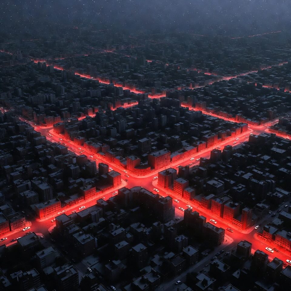
This framework employs drones to monitor traffic by collecting ultra-high-definition aerial footage from above. In the experiment conducted over the Songdo International Business District in South Korea, drones were flown over 20 intersections, recording nearly 12 terabytes of data over a period of four days! This footage captures traffic details in real-time, which are processed by AI-powered algorithms for object detection and tracking.
Key aspects of the framework include:
With the data collected, the researchers created two valuable datasets: the Songdo Traffic Dataset and the Songdo Vision Dataset. These are groundbreaking resources in the field of traffic management and urban planning:
One of the challenges in tracking vehicles from above is translating their position on video frames into real-world coordinates. This study tackled this by creating an orthophoto (a geometrically corrected aerial image that aligns with true scale) and using ground control points (GCPs) for precise calibration. With this, the drone footage’s coordinates can be accurately converted to longitude and latitude, allowing for real-world mapping.
One of the study’s standout results was how well the drone-derived data matched up with data collected from high-precision ground sensors, which are often installed on autonomous vehicles. The comparison between drone-captured data and traditional sensors confirmed that the framework could reliably replicate real-world traffic dynamics, even in dense urban areas.
This research provides a new foundation for how we monitor urban mobility:
This exciting drone-based framework shows a promising future for traffic monitoring that’s more adaptable, precise, and far-reaching than ever before!
Robert Fonod, Haechan Cho, Hwasoo Yeo, Nikolas Geroliminis. Advanced computer vision for extracting georeferenced vehicle trajectories from drone imagery. https://doi.org/10.48550/arXiv.2411.02136
From: École Polytechnique Fédérale de Lausanne (EPFL); Korea Advanced Institute of Science and Technology (KAIST).