A real-time Digital Twin platform using LiDAR and VISSIM accurately mirrors and optimizes intersection traffic, enabling smarter, safer, and data-driven traffic management.
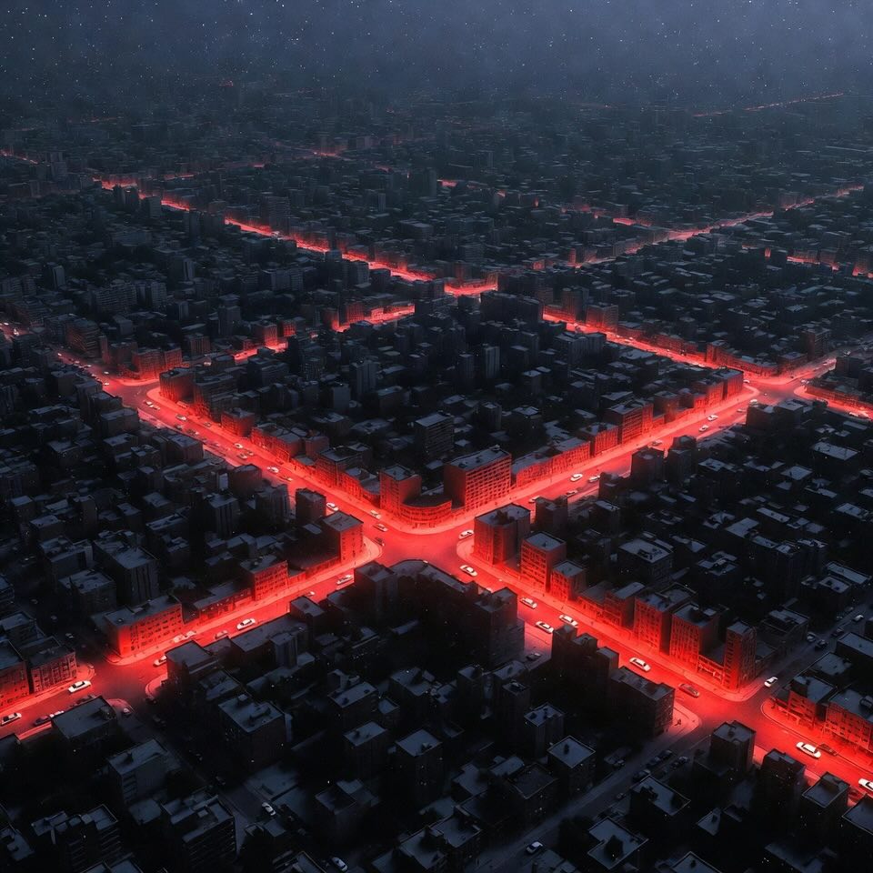
If you’ve ever been stuck at a red light with no cars coming from the other side, you’ve witnessed inefficiency in action. Intersections are the beating hearts of urban traffic networks — and also hotspots for congestion, accidents, and frustration.
Traditionally, city engineers have relied on manual counts, cameras, and simplified simulations to understand and improve intersection performance. But these methods come with big drawbacks:
This is where Digital Twin technology comes in — a high-tech, real-time, and data-rich approach to making our roads smarter and safer.
A Digital Twin is a virtual replica of a real-world system that updates continuously with live data. NASA first used the term to describe detailed simulations of spacecraft, and today, industries from manufacturing to healthcare are adopting it.
In transportation, a Digital Twin can:
Think of it as a living model of the city’s traffic — one that never sleeps, never guesses, and never ignores changing conditions.
A team at New Jersey Institute of Technology (NJIT) has created a real-time Digital Twin platform for traffic intersections. It combines:
The goal? Monitor, evaluate, and optimize intersections in real-time — making decisions based on facts, not forecasts from last year.
Here’s the step-by-step magic:
Result? A 29.8% reduction in trajectory error, meaning the simulation became far more accurate.
The researchers tested their platform at the Warren and Lock Street intersection near NJIT’s campus:
Key findings:
The Surrogate Safety Assessment Model (SSAM) also analyzed potential conflicts, detecting 131 instances (mostly rear-end situations).
This Digital Twin approach leapfrogs traditional methods:
| Feature | Old Way | Digital Twin Way |
|---|---|---|
| Data | Manual counts or camera feeds | High-resolution LiDAR, 24/7 |
| Accuracy | Dependent on visibility & human error | All-weather, centimeter-level |
| Simulation | Static, based on historical data | Dynamic, synced in real-time |
| Calibration | Time-consuming & manual | Automated via AI |
| Applications | Limited to observation | Prediction, testing, optimization |
In short, it’s not just seeing the present — it’s predicting and shaping the future of traffic flow.
The study’s authors see this as just the beginning. Here’s what could be next:
No technology is perfect, and the researchers acknowledge hurdles:
Still, these are solvable problems — and the benefits could far outweigh the costs for busy urban areas.
This NJIT project shows how Digital Twin + LiDAR + AI can transform urban traffic from a reactive system into a proactive, self-improving network.
It’s like giving the city’s intersections a brain, a memory, and the ability to learn from every passing car. As smart cities evolve, such platforms could make our commutes shorter, our roads safer, and our air cleaner.
The future of traffic isn’t just about more lanes — it’s about smarter intersections. And with Digital Twins, that future is already pulling up to the stop line.
Digital Twin - A virtual copy of a real-world system (like an intersection) that updates with live data so you can monitor, test, and improve it in real time. - More about this concept in the article "Digital Twins Tech | Reinvents Dike Safety".
LiDAR - A laser-based sensor that scans the environment in 3D, measuring distances very accurately — works day, night, and in bad weather. - More about this concept in the article "Can Self-Driving Cars Handle Long Expressway Tunnels?".
VISSIM - Specialized traffic simulation software that models how vehicles and pedestrians move, letting engineers test changes without touching the real road.
Genetic Algorithm - An AI-inspired optimization method that mimics natural selection theory to find the best solution to a problem — in this case, fine-tuning traffic models. - More about this concept in the article "Revolutionizing Heating Systems | How Predictive Control is Saving Energy in Commercial Buildings".
Traffic Microsimulation - A detailed computer model that simulates the movement of individual vehicles, giving a close-up view of traffic patterns.
Calibration - The process of adjusting a model so its results match real-world observations — like tuning a car engine for optimal performance.
Intersection Performance - A measure of how well an intersection handles traffic, considering delays, congestion, and safety.
SSAM (Surrogate Safety Assessment Model) - A tool that uses traffic simulation data to detect and analyze potential crash risks before they happen.
Afshari, A.; Lee, J.; Besenski, D. A Digital Twin Platform for Real-Time Intersection Traffic Monitoring, Performance Evaluation, and Calibration. Infrastructures 2025, 10, 204. https://doi.org/10.3390/infrastructures10080204