A recent research investigates how UAV (drone) technologies are currently being adopted by U.S. state DOTs and the FHWA for assessing transportation infrastructure, highlighting their benefits, challenges, and future needs for broader and more effective implementation.
Researchers dive deep into the real-world applications of UAVs across U.S. Departments of Transportation (DOTs) and the Federal Highway Administration (FHWA). Their research paper "Applications of UAV Technologies in Assessment of Transportation Infrastructure Systems" surveyed 27 DOTs and the FHWA to understand how these flying marvels are used in the field, what benefits they bring, and what’s standing in their way.
Let’s break it down in our classic simplified
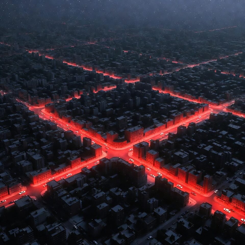
Inspecting infrastructure is no small feat. Traditionally, engineers had to conduct in-person inspections — which can be slow, expensive, and dangerous. Think bridge inspections over rivers or roadways surrounded by traffic.
That’s where UAVs come in. Drones can quickly fly over, under, and around structures to gather high-resolution images, videos, and sensor data. They can reach dangerous or tight areas safely, saving both time and lives. With tools like LiDAR, thermal imaging, and multispectral cameras, they can even spot internal issues before they become major problems.
In short, UAVs offer a smarter, safer, and more efficient way to monitor our roads and bridges — and the transportation industry is taking notice.
The study aimed to answer four big questions:
To find out, the team sent a detailed survey to all 50 state DOTs and the FHWA. They got back 35 full responses from 27 DOTs and the federal agency — a solid sample representing all four U.S. regions.
Nearly every DOT that responded is using drones already. 94% are using them for roads, and 88% are using them for bridges. Even culverts are getting drone love, with 73% of agencies inspecting them via UAVs. Sidewalks are less frequently assessed this way, with only 50% of agencies using drones for pedestrian infrastructure — largely due to tighter regulations in urban areas.
Interestingly, some DOTs are getting creative. California uses drones to inspect rockfall zones, Georgia monitors waterways and railroads, and states like Indiana and Iowa are even checking airports.
When asked about their main use cases, the top three were:
Fewer agencies are using UAVs for code violations or traffic surveillance — but that could change as drone tech continues to evolve.
One of the most practical drone applications is road surface assessment. Using drones equipped with optical or multispectral cameras, DOTs can identify potholes, cracks, and rutting with impressive precision. In one study, UAV imagery was compared to in-person measurements and showed errors of less than 3 millimeters. That level of accuracy means maintenance teams can act quickly, without the need for lengthy field assessments.
Bridges, with their complex geometry and structural risks, benefit enormously from UAV inspections. Drones can scan piers, beams, and connections with thermal sensors and LiDAR, identifying cracks or corrosion in hard-to-reach spots. The resulting 3D models allow engineers to simulate structural behavior, especially in areas prone to earthquakes or floods. Some DOTs are even using deep learning models to automatically detect cracks and anomalies in real time.
Forget old-school land surveys. Drones can fly over roads or construction sites and capture the data needed to generate digital elevation models, orthophotos, and 3D terrain maps. This is especially useful for landslide-prone zones or areas undergoing highway expansion. These surveys are faster, safer, and often more accurate than traditional ground methods.
Drones aren’t just for infrastructure — they help with traffic, too! By flying over highways, UAVs can monitor congestion, detect speeders, or reconstruct accidents with 4K video and 3D modeling software. In crash scenarios, they allow quick, non-intrusive data capture that helps both law enforcement and road planners.
Sidewalks may not seem high-risk, but cracks and uneven surfaces cause thousands of trips and falls every year. Using drones, agencies can create detailed models of pedestrian paths and evaluate them against ADA compliance standards. UAVs make it easier to map large urban sidewalk networks in a fraction of the time it would take inspectors on foot.
When asked what drones do best, agency reps had clear answers.
Overall, the average rating across all benefit categories (from 1 to 5) was around 4.1 — a clear vote of confidence.
It’s not all smooth flying, though. The top challenges holding UAVs back include:
And while privacy complaints and birds attacking drones were mentioned, these issues were less common. In general, the biggest hurdles are technical and regulatory — not public resistance.
After flying the drone, the next big task is processing the data. Agencies overwhelmingly prefer commercial software, such as Agisoft or Bentley ContextCapture, thanks to its ease of use, reliability, and integration with CAD/GIS platforms.
When asked what they want most in post-processing tools, agencies highlighted:
Automation — like auto-generated reports or AI-assisted problem detection — was less of a priority. It seems agencies are still cautious about handing over too much control to the machine. Many prefer human oversight, especially when dealing with safety-critical infrastructure.
So what do engineers dream of when it comes to drone upgrades? According to the survey:
Clearly, the engineering community sees drones as more than flying cameras — they want them to be intelligent, resilient inspection partners.
This study confirms what many of us in the engineering space have suspected: UAVs aren’t just buzzwords — they’re essential tools in modern infrastructure management. Roads, bridges, and sidewalks are safer, smarter, and more efficiently maintained thanks to drone technology.
But there’s still work to be done. Agencies need training, policy updates, and technological upgrades to make UAVs a seamless part of daily operations.
At EngiSphere, we’ll be watching the skies to keep you updated.
UAV (Unmanned Aerial Vehicle) - A flying robot (commonly called a drone) that's controlled remotely or flies autonomously — often equipped with cameras or sensors for data collection. - More about this concept in the article "Smarter Skies | How AI and Math Are Revolutionizing Urban Drone Swarms".
Transportation Infrastructure - The physical systems that keep people and goods moving — like roads, bridges, sidewalks, tunnels, and highways.
Bridge Components - The key parts that make up a bridge — such as the deck (where you drive), piers (vertical supports), and abutments (where the bridge meets the land).
Optical Camera (RGB Camera) - A regular camera that captures visible images (like your phone camera) — used by drones to take detailed pictures of infrastructure. - More about this concept in the article "SIGNIFY: Revolutionizing Sign Language Education with Gamification and AI".
Infrared (IR) Thermal Camera - A special camera that detects heat instead of light — useful for spotting cracks, leaks, or stress areas by measuring temperature differences. - More about this concept in the article "Spotting Fires in a Flash".
LiDAR (Light Detection and Ranging) - A sensor that uses lasers to measure distances — it creates super-precise 3D maps of surfaces, even in low light or dense areas. - More about this concept in the article "Revolutionizing Autonomous Driving: MapFusion's Smart Sensor Fusion".
GPR (Ground Penetrating Radar) - A radar system that looks underground or into solid structures — helps detect buried utilities, voids, or internal damage in pavement and bridges.
Multispectral Camera - A camera that captures images beyond normal human vision — useful for analyzing surface conditions, vegetation, or materials.
Deep Learning / CNN (Convolutional Neural Network) - A type of artificial intelligence that teaches computers to recognize patterns — like identifying potholes or cracks in drone photos. - More about this concept in the article "Smart Bees, Smarter Tech | How Deep Learning is Changing Hive Monitoring Forever!".
Orthophoto - A drone-captured image that’s been corrected for scale and angle — basically a super-accurate aerial map. - More about this concept in the article "Revolutionizing Traffic Monitoring: Using Drones and AI to Map Vehicle Paths from the Sky".
3D Point Cloud - A digital group of tiny dots in space that represent the shape of an object — used to create detailed 3D models of roads and structures. - More about this concept in the article "Revolutionizing Maize Farming: 3D Rail-Driven Plant Phenotyping for Real-Time Growth Monitoring".
Post-Processing Software - Computer programs that clean up and analyze data after it’s collected — turning raw drone images into maps, models, and reports.
Zaman, A.A.U.; Abdelaty, A.; Yamany, M.S. Applications of UAV Technologies in Assessment of Transportation Infrastructure Systems. CivilEng 2025, 6, 32. https://doi.org/10.3390/civileng6020032