A recent paper shows that Unmanned Aerial Vehicles can collect significantly more sensor data by smartly hovering at high-quality wireless links and considering sensor data buffers, instead of constantly chasing the strongest signal.
Unmanned aerial vehicles (UAVs) are no longer just flying cameras or delivery tools. Today, they play a crucial role in emergency response, environmental monitoring, smart cities, and wireless communications.
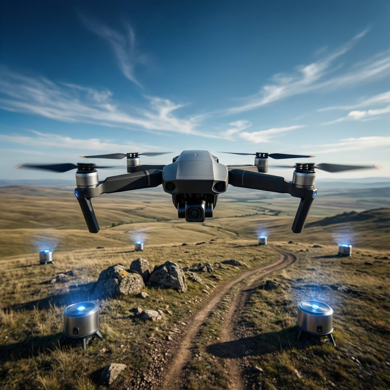
Imagine a disaster zone after an earthquake. Ground sensors are collecting vital data—temperature, gas leaks, structural vibrations—but communication networks are damaged. A drone can fly in, collect data wirelessly, and return safely. In this role, the drone acts as a data mule—physically moving data from sensors to a control center.
But here’s the challenge:
So how can a drone decide which sensor to connect to, when to move, and when to hover?
This is exactly the problem tackled by a recent research study on resilient UAV data collection, and in this article, we explain its ideas in simple terms.
Many existing UAV strategies follow a simple rule:
“To maintain peak performance, always select the sensor with the most favorable signal strength.”
This is known as a Greedy strategy.
While it sounds reasonable, in real-world environments it causes problems:
In short, chasing the strongest signal all the time is inefficient.
The researchers propose a better approach called:
HGAD – Hover-based Greedy Adaptive Download
Instead of always moving, the UAV:
Think of it like this:
Instead of running between shops to grab one item at a time,
the drone waits inside the best shop and finishes shopping properly.
Here’s the setup:
The UAV continuously decides:
HGAD makes these decisions based on real-time signal quality and remaining data.
The research explores two realistic UAV operating modes:
The drone follows a predefined flight path (due to regulations or safety rules).
HGAD improves performance by hovering at strong signal locations along the path.
The UAV can change its route dynamically.
This mode shows how intelligent navigation + smart downloading leads to better results.
Many drone algorithms look great in simulations—but fail in reality.
This study is different because it uses:
The real-world tests include:
This makes the results practical and trustworthy.
Across all test scenarios, HGAD consistently outperformed the traditional Greedy approach.
In actual drone flights:
This proves that hovering at the right moment is more powerful than constant motion.
This research has important implications for:
Emergency Response - Drones can reliably collect data from damaged infrastructure when networks fail.
Environmental Monitoring - UAVs can gather sensor data from forests, farms, or oceans with better efficiency.
Smart Cities & IoT - Urban sensors can offload data using drones without overloading networks.
Autonomous Systems - Shows how simple intelligence rules can outperform complex movement strategies.
The researchers outline exciting next steps:
AI-Powered Learning - Using reinforcement learning, drones could learn optimal behaviors over time.
Digital Twin Integration - Closer alignment between simulation and real-world performance.
Multi-UAV Cooperation - Multiple drones sharing tasks without overlap or interference.
6G and Beyond - Supporting future ultra-reliable wireless networks using aerial platforms.
By combining signal awareness, buffer awareness, and strategic hovering, Unmanned aerial vehicles can become far more reliable data collectors—especially in critical, real-world missions.
For engineers, researchers, and policymakers, this work highlights how small algorithmic changes can lead to big real-world gains.
Smarter decisions, not faster movement, are the future of UAV intelligence.
Unmanned Aerial Vehicles (UAVs) - Aircraft that fly without a human pilot onboard, controlled remotely or autonomously, often used for sensing, communication, and data collection. - More about this concept in the article "Conical Wireless Charger for UAVs".
Data Mule - A mobile device (like a UAV) that physically moves data between sensors and a base station when direct network connections are unavailable or unreliable.
Wireless Sensor - A small device placed on the ground that collects data (temperature, images, signals, etc.) and sends it wirelessly when a connection is available. - More about this concept in the article "Ultra-Sensitive Soil Moisture Sensor Revolutionized with Photonic Crystals".
Signal-to-Noise Ratio (SNR) - A measure of signal quality, comparing useful signal strength to background noise—higher SNR means faster and more reliable data transfer. - More about this concept in the article "Cracking the Code of Skyscraper Safety | How AI Is Revolutionizing Structural Damage Detection!".
Throughput - The actual amount of data successfully transmitted per second over a wireless link, usually measured in Mbps.
Hovering - When a UAV stops moving and stays in one position to maintain a strong and stable wireless connection with a sensor.
Greedy Algorithm - A decision-making strategy that always chooses the best immediate option, such as connecting to the strongest signal at the current moment.
Adaptive Algorithm - An algorithm that changes its behavior in real time based on current conditions like signal quality, remaining data, or time limits.
Sensor Data Buffer - Temporary storage inside a sensor that holds data waiting to be transmitted to the UAV.
Geofence - A virtual boundary that restricts where a UAV is allowed to fly due to safety, legal, or mission constraints.
Digital Twin (DT) - A virtual copy of a real-world system that mimics real behavior, used to test UAV algorithms before real deployment.
Real-World (RW) Testbed - A physical experimental setup where UAVs and sensors operate in actual environmental conditions, including noise and interference.
Wireless Propagation - The way radio signals travel through space, affected by distance, buildings, terrain, and obstacles.
Autonomous Trajectory - A flight path that the UAV decides by itself in real time, instead of following a pre-planned route.
Mission Time Constraint - A fixed time limit within which the UAV must complete data collection and return safely.
Path Loss - The reduction in signal strength as wireless signals travel farther or encounter obstacles.
Resilient Communication - A communication strategy designed to keep working reliably even when conditions change or degrade.
Scheduling - The process of deciding when and from which sensor the UAV should download data.
Wireless Channel Variability - The natural fluctuation of signal quality over time due to movement, interference, and environmental changes.
Md Sharif Hossen, Anil Gurses, Ozgur Ozdemir, Mihail Sichitiu, Ismail Guvenc. Resilient UAV Data Mule via Adaptive Sensor Association under Timing Constraints. https://doi.org/10.48550/arXiv.2601.06000